Skip to content
E-NAMTILA

E-NAMTILA

THE SYRIAN ELECTRONIC ACADEMIC DATABASE

  • INTRODUCTION
  • JOURNALS
    • DYSONA – LIFE SCIENCE
    • DYSONA – APPLIED SCIENCE
  • Become a Reviewer
  • PUBLICATION ETHICS
  • CONTACT

Author: E-NAMTILA

Remote sensing-based monitoring of peri-urban landscape dynamics: A case study of Rupganj, Bangladesh
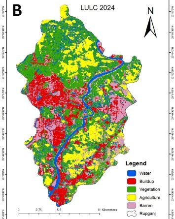
DYSONA - APPLIED SCIENCE 

Remote sensing-based monitoring of peri-urban landscape dynamics: A case study of Rupganj, Bangladesh

August 5, 2025August 5, 2025 E-NAMTILA
Read more
Evaluation of anther culture and callus induction efficiency in three cauliflower genotypes using different media compositions
DYSONA - APPLIED SCIENCE 

Evaluation of anther culture and callus induction efficiency in three cauliflower genotypes using different media compositions

July 26, 2025July 26, 2025 E-NAMTILA
Read more
Urban flood susceptibility mapping using the AHP model and geospatial tools in Quwaiq River Basin, Aleppo Governorate, Syria
DYSONA - APPLIED SCIENCE 

Urban flood susceptibility mapping using the AHP model and geospatial tools in Quwaiq River Basin, Aleppo Governorate, Syria

July 24, 2025July 24, 2025 E-NAMTILA
Read more
Evaluating the impact of digital number to surface reflectance conversion on the accuracy of NDVI and NDWI: A case study of Sabkhat Al-Jabbul, Syria
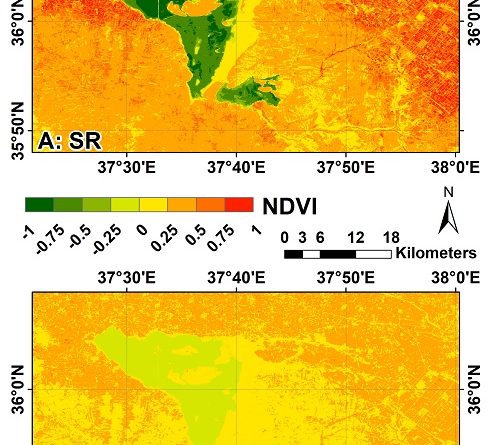
DYSONA - APPLIED SCIENCE 

Evaluating the impact of digital number to surface reflectance conversion on the accuracy of NDVI and NDWI: A case study of Sabkhat Al-Jabbul, Syria

June 22, 2025June 22, 2025 E-NAMTILA
Read more
An improved MobileNetV2 architecture for efficient roadside accident detection in CCTV footage
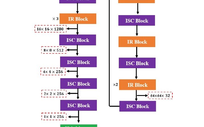
DYSONA - APPLIED SCIENCE 

An improved MobileNetV2 architecture for efficient roadside accident detection in CCTV footage

June 8, 2025June 8, 2025 E-NAMTILA
Read more
Predicting the spatial patterns of soil erosion hazard using RUSLE and frequency ratio in the Silabati River Basin, eastern India
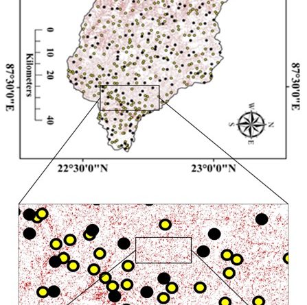
DYSONA - APPLIED SCIENCE 

Predicting the spatial patterns of soil erosion hazard using RUSLE and frequency ratio in the Silabati River Basin, eastern India

May 28, 2025May 28, 2025 E-NAMTILA
Read more
A spatiotemporal analysis of air pollutants during and after COVID-19: A case study of Dhaka Division using Google Earth Engine
DYSONA - APPLIED SCIENCE 

A spatiotemporal analysis of air pollutants during and after COVID-19: A case study of Dhaka Division using Google Earth Engine

May 20, 2025May 21, 2025 E-NAMTILA
Read more
Morphometric analysis for flash flood hazard mapping: A case study of the Abu Al-Ward River Basin
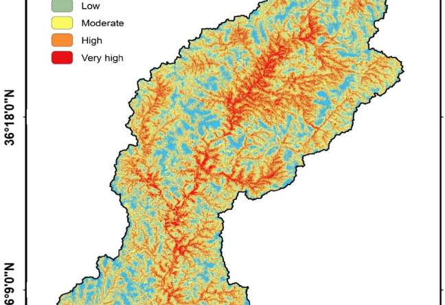
DYSONA - APPLIED SCIENCE 

Morphometric analysis for flash flood hazard mapping: A case study of the Abu Al-Ward River Basin

May 15, 2025May 15, 2025 E-NAMTILA
Read more
Factor analysis of key drivers shaping agricultural entrepreneurship in Bamyan, Afghanistan
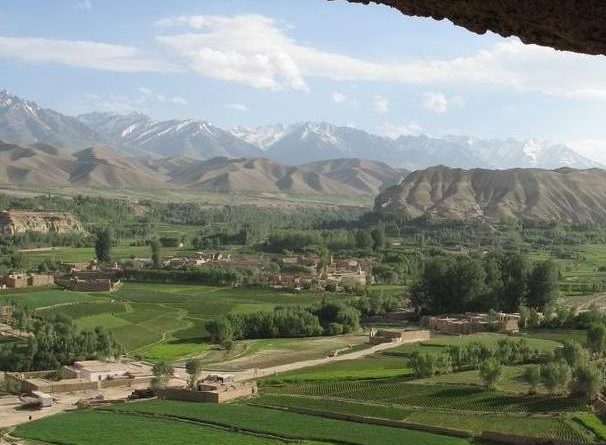
DYSONA - APPLIED SCIENCE 

Factor analysis of key drivers shaping agricultural entrepreneurship in Bamyan, Afghanistan

May 5, 2025May 5, 2025 E-NAMTILA
Read more
Spatiotemporal monitoring of the surface water level dynamics in Lake Tuz, Türkiye, using remote sensing and GIS
DYSONA - APPLIED SCIENCE 

Spatiotemporal monitoring of the surface water level dynamics in Lake Tuz, Türkiye, using remote sensing and GIS

May 1, 2025May 1, 2025 E-NAMTILA
Read more
  • ← Previous
  • Next →
  • PUBLICATION ETHICS
  • RECRUITING
  • PRIVACY POLICY
  • TERMS AND CONDITIONS
  • CONTACT US
  • DYSONA JOURNALS
  • DYSONA ARCHIVE
  • DYSONA - Applied Science
  • DYSONA - Life Science
  • GUIDE FOR AUTHORS
Creative Commons License
All the works published by E-NAMTILA and the related publication media are Open Access licensed under a Creative Commons Attribution 4.0 International License.
Copyright © 2025 E-NAMTILA. All rights reserved.
Theme: ColorMag by ThemeGrill. Powered by WordPress.